Friday, June 24, 2011

Paradise Valley Climbs

Paradise Peak (5477 feet) and Delgga Mountain (5510 feet)
June 23, 2011
9 hours roundtrip

After missing out on some earlier opportunities, I decided to play hookie and take advantage of the nice weather.  So far this summer, my climbing had amounted to a number of nice climbs but no new summits due to weather, snow conditions and technical difficulties.  

On June 23rd I went from the Crow Pass trailhead above Girdwood into the Raven Creek and Paradise Valley drainages to climb Paradise peak and Delgga Mountain as shown on the map below.  

Paradise peak is a simple walkup.  On Delgga, I decided to climb the East ridge proper and had to to some low level 5 scrambling with lots of exposure.  On the way down I used some southfacing scree couloirs to assist my descent. 


Crow Pass with Raven Glacier and Rook Mnt in the background

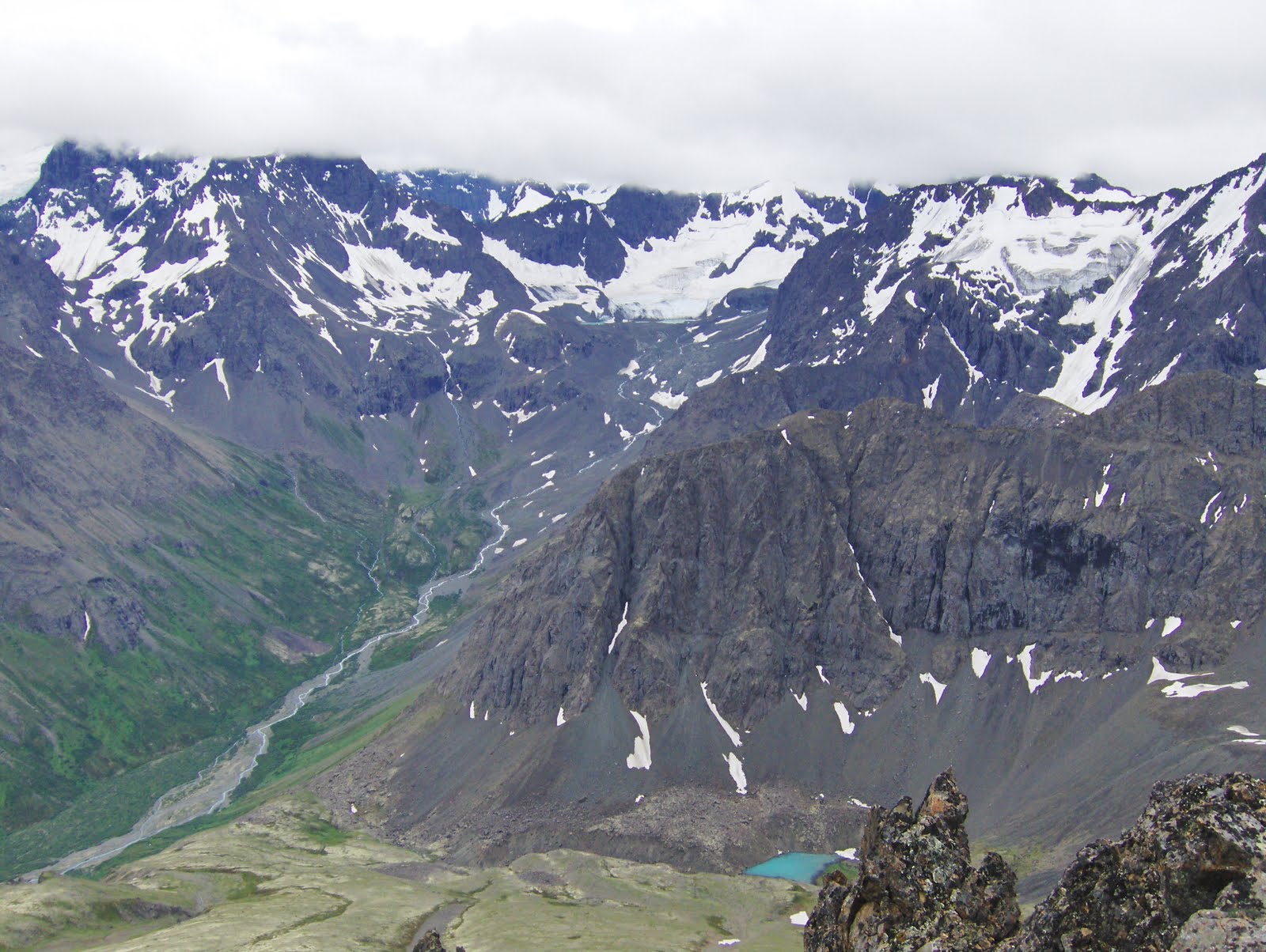
Panorama from Paradise peak looking Northwest

Panorama from Paradise peak looking Southeast

Panorama from Delgga Mnt looking West into North Fork Ship Creek and Camp Creek drainages

Paradise Peak (5477 feet) from Delgga Mnt

Delgga Mnt (5510 feet) from Paradise Peak

Panorama from Crow Pass overlooking Raven glacier, Summit Mnt and Rook Mnt.

Sunday, March 27, 2011

Nancy Lakes Cruising

Having tested the conditions around Nancy Lakes (just off the Parks Highway North of Wasilla) the previous weekend, I decided to go for a longer skate ski on the snow-machine trails around the Nancy Lakes State Park area on Sunday, March 27th, 2011. 

The total trip, outlined below, was just over 30 miles.  Skiing on the snow machine trails works great and there are not that many snow machiners this time of the year.

I skied the Nancy Lakes Parkway from the winter access at mp 2.2 to the end of the road at mp 6.6, then followed the summer trail to Red Shirt Lake.  From there I skied across Red Shirt Lake, Cow lake, West and East Butterfly Lakes, Bucklet Lake #1, Candlestick Lake, Echo Ponds Nos 1, 2 & 3, Lynx Lake, Little Frazer Lake, Charr Lake, Owl Lake, James Lake, Chicken Lake, Big & Little Noluck Lakes, and Tanaina Lake, before finishing back along the Nancy Lakes Parkway to the trailhead.

Skiing the lakes area can definitely be recommended.  Especially this time of the year when most of the snow machiners have gone home.  It is almost like crust skiing.  And there are almost endless trails in the area.


Looking South across Red Shirt Lake.  Superb skiing.

Connector trail to Big Lake trail system South of Cow Lake.  Most of the trails are very wide and great for skating.  Some of the Nancy Lakes portages are single track which makes for a nice change.  Perhaps some day we could do the Oosik Classic ski race here!


Saturday, March 26, 2011

Indian to Arctic

On the spur of the moment and with a good weather forecast, Per Arne and I decided on Friday evening to ski the Arctic to Indian trail the next day.  To simplify the logistics, Per Arne started at the Arctic (North) end and I skied from the Indian (South) end.  We met at the middle and exchanged car keys. 

I have done the Arctic to Indian traverse many times before, but always as touring with a group of people.  This time I decided to make it a workout.  Going fairly light but with back-country skies, I used 3:45 on the roughly 20 mile traverse.  Rode Multigrade wax gave good grip all the way except the last hills up to the Arctic Valley trailhead.  A blue-bell day, about 25 degrees F at the start, and 2 inches of fresh powder at the pass made it a fantastic traverse.

Map of the Arctic to Indian traverse

Looking up Indian valley early in the morning.  The mountain in the mist is Avalanche Peak.

View of Turnagain Arm from high in the Indian Valley.

Powerline Pass with Homocide Peak on the left and Avalanche Peak on the right.  One of my favorite crust-ski gully is the right-hand gully leading down from the low-point on Powerline Pass.

Halfway across I met up with Per Arne for a brief rest stop and exchange of car-keys.

Wednesday, September 15, 2010

Bolivia September 2010

Condoriri to Huayna Potosi Trek & Volcan Sajama Climb

I had wanted to return to Bolivia ever since we climbed Illimani in 1998. When Geir Ulstein suggested we climb Bolivia's highest mountain, Volcan Sajama, I was quick to concur. I spent three days acclimatising in Peru before meeting up with Geir in La Paz. We then continued the acclimatization with three days of trekking from Condoriri to Huayna Potosi in the Cordillera Real. Then, after two days of rest in La Paz, we headed West to the Sajama National Park for our main objective. Unfortunately, I picked up some stomach bug in La Paz and never made it higher than 5700 m (18700 ft) on Sajama. Geir did much better and successfully summitted Sajama on a 10 hour long summit day. Lots of penitentes made it a long summit day.


This first picture shows a panorama of the Eastern part of the Cordillera Real rising above the Altiplano with Ancohuma and Illampu on the left and the Condoriri group on the right. We would trek up to the Condoriri basecamp and then head West to Refugio Huayna Potosi over three days of great trekking at elevations between 14700 and 16700 ft.

Trailhead at the small village of Tuni, elevation 14740 ft.

Lots of Alpacas and Llamas, and they weren't particularly shy.

Aren't they cute!

Condoriri (18530 ft, 5648 m) makes an impressive backdrop on the first day of trekking.

The Condoriri group at sunset with basecamp in the foreground.  This area has lots of great trekking, camping and climbing.  I will have to return someday to spend some more time here.

Condoriri summit pyramid.  The normal route follows the facing ridge.

Glacier with normal route leading to Pequeno Alpamayo (5370 m, 17620 ft)

Panorama looking back at the Condoriri group from the West.

Locals enjoying the scenery.

Between Condiriri and Huyana Potosi we crossed 3 valleys and 4 passes (up to about 5100 m, 16700 ft). This shot shows the arid conditions climbing out of one of these major valleys.

Lunch at an abandoned farm house along the way.

Second night camp-site at sunset. Wide open and beautiful.  As soon as the sun sets it gets very cold. Luckily it didn't blow too much while we were there.

The three day trek ended at the Huaya Potosi refugio.

Huyana Potosi (19996 ft, 6094 m) - the normal route goes up the scree slopes and glacier in center and the accesses the right hand ridge. Look closely and you can make out parts of the trail up the normal route.

Geir (right) and Dr. Hugo (Dr. Hugo Berrios Martin is the founder of Refugio Huayna Potosi).

Illimani (6492 m, 21300 ft) in the sunset as seen from downtown La Paz

Volcan Sajama rises above the desert. Sajama is Bolivia's highest mountain at 6530 m (21424 ft). It was the main objective of our trip.

Impressive volcano even though a lot of the ice-shield has melted.

Volcan Sajama seen from the town of Sajama.

Hiking in to basecamp with Pomerape (6222 m) and Parinacota (6132 m) in the background. These fine volcanoes straddle the Bolivia-Chile border.

Sajama in the sunset as seen from basecamp.

Heading up the very loose screen towards highcamp.

Highcamp on Sajama at about 5500 m (18050 ft).

The slopes leading to the canaleta and the glacier edge.

Geir returning after successful summit attempt.

Heading back out with Sajama in the background.

Waiting for transportation. From here we headed down to the village of Sajama for hot food and a beer.

Heading back to La Paz the next day. The Sajama National Park is basically a desert.

Returning to La Paz with its congested traffic and pollution. Huayna Potosi can be seen rising over the smog of El Alto outside La Paz.

Saturday, September 4, 2010

Ram Valley - Pleasant and Not So Pleasant Peaks

Ram Valley and Falling Water Valley

The Prudhoe Bay road provides easy access to the Ram Valley and Falling Water Valley in the Eagle River drainage.  Summer 2010 was perfect for completing all the peaks along the Eagle River north of the Ram Valley.  These include Peak 5331, Mt Significant (5456 ft), Peak 5320, Pleasant Mountain (6463 ft), Raina Peak (6798 ft) and Peeking Mountain (6925 ft).  Of these, Pleasant Mountain was by far the least pleasant of the group with terrible scree and sketchy scrambling. 

I had noticed these nice ridges above Eagle River last fall when I climbed Mt Significant.  The weather earlier this summer had not been conducive to climbing the higher of these peaks.  Low cloud cover and poor visibility forced me to stay low, and come August, I had only climbed the 5000-footers in this drainage.  But then a couple of nice days in early fall allowed us to visit the more interesting 6000-footers.


August 8th, Adam Lewis and I headed up Ram Valley to climb Pleasant Mountain.  The clouds broke apart just long enough for us to see the summit and where to go.  Why anybody named this Pleasant Mountain is beyond me.  The upper part of the mountain is bad scree and involves sketchy scrambling without any protection.  On the way back down, we studied the Raina Peak and Peeking Mountain route.  These two mountains promised to be more pleasant than the mountain we had just climbed.

So when the weather once again offered another great Alaska day for climbing on September 3, Toby Schwoerer, Adam and I headed up Ram valley with the intention of climbing Raina and Peeking.  And even though the clouds swirled around us on the summits, we enjoyed fantastic hiking and climbing on these two peaks.  Raina and Peeking are real pleasures compared to Pleasant Mt.  Just over 6 hours roundtrip made for a great late summer outing.  We were three happy climbers heading back to town.  At least we had gotten our addiction satisfied for a little while.  Unfortunately, I had brought a camera with dead batteries - the other guys brought no cameras at all - so this blog-post uses some photos I took earlier in the summer.

This first photo is from June 2010 from the ridge leading to Mt Significant.  In the near background is Peak 5320.  Directly over the top of my head is Peeking Mt. and to my right is Raina Peak (the middle summit of Raina being the tallest).

Typical climbing conditions this year.  Lots of fog and clouds obscuring the summits.  Here are Raina (left) and Peeking (right) as seen from the summit of Pleasant.

Ram Valley with Mt Pleasant  in the background.


Upper reaches of Ram Valley.  Bombardment pass is left center.  Korohusk peak (7030 ft) is sticking its summit into the clouds.

Looking down onto the Ram Valley rock glacier with Cumulus Mt (5830 ft) in the background.

From the summit of Mt Pleasant looking East into the headwaters of Peters Creek.  Bellicose Peak (7640 ft) hiding in the clouds (left side of picture).

Coming down the gully from Pleasant Mt.  The scree was good for coming down but really hard work to get up.

Successfully down.  Our tracks are clearly visible in the lower scree gully.

Adam with Raina Peak in the background.  Raina and Peeking turned out to much more pleasant than Mt Pleasant itself.  The ridge between Raina and Peeking is non-technical and has a decent trail leading to the summit of Peeking.  There is only one short section descending from Raina to the saddle between Raina and Peeking that is a little scrambly, otherwise it is a simple walk-up.

Panorama of the upper Ram Valley.  Pleasant Mt. on the left, Korohusk in the middle and Cumulus on the left.

Hope we still get some good clminging days before the snow start flying.

Cheers,
Trond