Saturday, October 14, 2006

Triangle Peak - October 2006

Triangle Peak, Chugach Mountains
Climbed October 14, 2006
5 1/2 hour roundtrip from South Fork Eagle River trailhead.


Cantata Peak from West


Calliope Mnt South face

On Triangle Peak summit looking Southeast

On Triangle Peak summit looking South

Looking down Triangle's NW ridge

Triangle Peak SW ridge (right hand ridge)


North Fork Eagle River towards the West


North Fork Eagle River towards the West; Mt McKinley in the distance
View from the West: Triangle Peak to the right, Calliope to the left

Parting shot of Cantata (left), Calliope (center) and Triangle (right)


Wednesday, August 30, 2006

Brooks Range August 2006

Brooks Range August 2006

Arrigetch Mountains Hike and Alatna Raft Trip

In August 2006 I drove with 7 friends to up the Dalton highway to Coldfoot were we flew with Coyote Air to the Alatna River. The people on the trip were Trond Flagstad, Lindsey Flagstad, Toby Schwoerer, Rachel Steer, Geir Ulstein, Per Arne, Claire Norton-Cruz and myself. We hiked and camped in the Arrigetch mountains for two days and then rafted (or floated is more like it) for 4-5 days down the Alatna river to our pick-up point. We had variable weather (2 days very nice, 1 day of snow in the Arrigetch, and 4 days of rain and drizzle on the Alatna). There were few mosquitos and even less wildlife (the only animal of any size was a bull moose crossing the Alatna river) ... but there were plenty of signs of wolf, bear and other critters.


On the Arctic Circle (Per Arne, Geir and Claire)
Our transport to the bush - Coyote Air - from Coldfoot.
The landing strip along the Alatna river
Gorgeous weather the first two days
Getting ready to hike up the Arrigetch creek (Trond Flagstad, Lindsey, Claire, Geir, Per Arne, Rachel and Toby)
How to ford a creek ....
Per A and Geir ... "where is the trail? You promised a trail!"
Arrigetch Peaks in the distance
Halfway there is a great dry knob for resting or camping
Staring out in a heat wave and ending up in a drenching rainstorm before we got to our campsite at the foot of the Arrigetch peaks, popularly called the Meadow Camp.
Our campsite. Toby and Rachel later realized that that had put their tent on top of a squirrel's hole. The poor thing had to dig a new exit to get out!
Strange creatures live in the Arrigetch
Upper Arrigeth Creek
Granite walls famous for climbing
More climbing opportunities
Trond F and Lindsey serving up burritos
South fork Arrigetch Creek
Arrigetch ... native name meaning "fingers of a hand outstretched"
The next morning ... a dusting of snow.
Breakfast before heading back down to the Alatna
Parting shots of the granite walls
and the Arrigetch creek
Real bushwhacking.
Trond F finds himself a tree with some possibilities
Back on the "beach". The big question was whether the bears had left our food and rafts alone for the three days we had been gone. We had stashed everything as high as possiblew in some trees and there was no damage!
Trond F and Lidsey getting ready to hit the river. We now had four intensive days of rafting ahead of us. We averaged 6-8 hours on the river each day and made the stipulated 6 day downriver trip in 3 1/2 days.
The crew ... Geir, Claire, Toby, Trond F, Lidsey and Rachel.
Toby and Rachel in their "rubber ducky"
Trond J impatient with the photographer as the rain was starting to come down hard.Typical river condition ... class I. There was only a short section of class I+
Sacrificial burning of Per Arne's "state-of-the-art" norwegian Viking hiking boots.
Camp activities while waiting for the Coyote air pickup
... or just sit around and be bored like Geir and Per Arne (I think they'd had enough of the rain at this point).
Finally ... our ride back to civilization.

Tuesday, July 11, 2006

Chugach 12 Summits Linkup

Chugach 12 Summits Linkup
July 9th, 2006, Joe Stock and I climbed all 5000 foot summits in the Western Chugach in a single 23 hour push, starting at the Rabbit Lake trailhead and finishing and the Snowhawk Valley Trailhead. For a writeup of the excursion, see http://www.trailrunnermag.com/article.php?id%20=97&cat=8. Here are some of the photos from the 20000 vertical feet, 40 mile crusher:


Starting out at 04:10 am on July 9th, 2006, from the Rabbit Lake trailhead

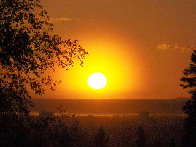
City of Anchorage waking up behind us

Foggy and rainy in the early morning, here in the way up to the first summit, South Suicide

N. Suicide from S. Suicide

Clearing weather!

Back down in the fog ... North ridge of N. Suicide


Summit of Avalanche Peak

This is where we're going ... the Ramp, Hidden Peak and O'Malley Peak

The Ramp, Williwaw Mnt, the Tanainas, and Temptation Peak

Joe's wife and friend Andrew met us at the Ramp with lunch (thanks guys!)

Summit of the Ramp with Avalanche Peak in the background


Heading up the snow gully to Williwaw Mnt

Long lake and the Tanainas from Williwaw Mnt

5 minutes rest on the summit of Koktoya Peak

Long lake from Koktoya with ominous weather coming in
Looking towards Anchorage


Tanainas from summit of Tikishla

Heading up Temptations peak (#12) in waning light and closing fog

Starting the long decent and hike out Snowhawk valley in the dark

After 3 hours of bushwhacking out the Snowhawk valley we finally hit the road and trailhead at 03:23 am on July 10th.