Sunday, November 11, 2012

Nancy Lakes Skate

November 11th, 2012
Nancy Lakes Ice Skate and Skate Ski
16 miles, 3 hrs

Cold temperatures and little snow set up very good ice skating opportunities around Anchorage in early November.  We grabbed the chance on Sunday to test the conditions on Nancy Lakes.  And we were not disappointed.  Perfect ice under 3 inches of fluff. 


Flash starting out on Tanaina Lake. Nice form!


Trond Flagstad on Tanaina Lake.

Sunshine and perfect conditions.

We made a 16 mile loop where we crossed some 20 lakes.  The lakes are quite close together and trails connect the lakes making the "portages" very easy.

Even skate skiing was pretty decent, although the snow had not bonded to the ice so the conditions put a premium on riding on a flat ski ... good for early season technique work.

Flash making a turnaround on one of the small sloughs.

Trond F and Flash coming back across Echo pond.

Equipment malfunction: Trond F had to one-skate the last 3 miles when a binding came off of one of his skates.  It didn't seem to slow him down much though.  I still had a hard time keeping up on my skate skis.

Saturday, October 13, 2012

Ship Creek Hill

Ship Creek Hill, 3845 feet
October 13th, 2012, with Per Arne Pedersen
7 hours roundtrip, 20 kms (12.5 miles), 5760 feet total vertical gain

One more mountain hike before winter sets in.  Per and I headed out from Stuckagain Heights early morning on October 15th, hoping the weather would hold long enough for a roundtrip to Ship Creek Hill.  Ship Creek Hill is a true summit in the ridge from Temptation Peak.  We took the easy trail to the Dome and then headed down across the South Fork of Chester Creek and then up and over a low pass that I like to call Snowhawk Pass, elevation 2475 feet.  From there we crossed Snowhawk Valley and Snowhawk Creek before heading up to Ship Creek Hill.  The return followed basically the same route. 

This is a great day hike.  Most of the hike is above timberline, and if you pick your route well you can avoid most of the brush.  However, crossing Snowhawk Creek can be a challenge, especially after big rains like we'd experienced all through September and October. 


Ship Creek Hill (second peak from the left) as seen from Snowhawk Pass

Per heading up the easy slopes towards Ship Creek Hill. 

Summit photo of Trond and Per.

Moose rub.


How to cross a freezing creek? ....
.... not exactly, but your way works too Per.


Snowhawk Creek in late fall shroud.

If it snows more now, I might as well put on my skis.

North to East panorama from Snowhawk Pass. Ship Creek Hill is second peak from the left. The highpoint in the right center is Temptation Peak. On the right are the Tikishla and Kanchee Peaks

Saturday, August 11, 2012

Indian Pass Peaks - 10 Aug 2012

Indian Pass Peaks (Bidarka, 3835 ft; The Wing, 4985 ft, Shaman's Dome, 4010 ft)
August 11th, 2012, with Ian and Jen.
19 miles (30 kms), 7900 total vertical (2415 m), 10.5 hrs round trip.

I had (as usual) big plans for the day and hoped to summit 5 peaks in the Indian Pass area on this gorgeous Saturday.  But distances are deceiving and we "only" managed to summit three peaks.  This area offers some great tundra travel.  We didn't see anybody all day.  It is amazing to have this entire area to ourselves.

We started from the Indian Valley trailhead and bush-whacked up the trail to Indian Pass.  The trail is not much travelled and thus very overgrown this time of the year.  From the Indian Pass we headed up the easy ridge to the Bidarka Peak (3835 ft) and then descended to a little tarn North of Bidarka were we had an early lunch.  After lunch we crossed the ridge between the Beak (4730 ft) and the Wing (4985 ft) and traversed towards the col between the Wing and Bird's Eye Peak (4970 ft).  But the West ridge of Bird's Eye Peak seemed too technical for running shoes and shorts, so we cancelled our plan for Bird's Eye and headed back up to the summit of the Wing.  After the Wing we had hoped to traverse directly North to the Tail Feather Peak (4960 ft), but this ridge was also much too technical so we decided to head back West and bag Shaman's Dome (4010 ft) before returning via the col between Bidarka and Bird Ridge Overlook ("Bidarka" Pass).  After an hour of serious bushwhacking we were back on the Indian Valley trail and another hour of bush-whacking down the Indian Valley trail put us back where we started 10.5 hours earlier.


Water stop at the Indian Pass before heading up Bidarka.

Jen and Ian on Bidarka with Turnagain Arm in the background.

Bird's Eye Peak.

The Wing

The Beak (left) and Bird Ridge Overlook from high on the Wing

Summit ridge of the Wing.

Jen and Ian on the Wing

Trond on the Wing with Tail Feather Peak in the background.

Decadent.  Jen and Ian enjoying a brewski on the Wing with Bird's Eye Peak in the background.

Summit of Shaman's Dome.  In the background are Ptarmigan (left), the Wedge, and the Ramp)

The Sail seen from Shaman's Dome.

Tail Feather (left) and the Wing (right).  We descended the left-hand-side ridge from the Wing.  An interesting ridge; 30-40 degrees ridge with lots of loose gravel on friable Chugach crud.

The Beak (left) and Bird Ridge Overlook seen from Shaman's Dome.  Our return was via the pass ("Bidarka" Pass) between Bird Ridge Overlook and Bidarka seen as the low point on the right hand side of the photo.

On "Bidarka" Pass.

Eastward panorama from the Wing.  Left to right are Bird's Eye Peak (4970 ft), Esbay Peak (4050 ft), Bird Peak (5505 ft), Nest Peak (5030 ft), and Penguin Ridge.

Northward panorama from "Bidarka" Pass.  Left to right are Shaman's Dome, the Wing, and the Beak.

Sunday, August 5, 2012

Nagoon Mountain (4403 ft)

Nagoon Mountain (4403 ft) in the Berries Group, Chugach Mnts
Sunday, August 5th, 2012
19 miles, 5690 ft total vertical, 7 hours roundtrip

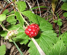
Sunday, August 5th, was another overcast weekend day (like most other weekend days this summer) with the cloud ceiling hovering around 3500 - 4000 ft.  The weather looked a little better to the East so I decided to head out to the Berries.  It had been a few years since I had been up the Berry Pass, so I thought I could at least go that far.  And if the weather cooperated, I would try Nagoon Mountain, the northernmost mountain in the Berries.  Most of the peaks in the Berries have berry names. Nagoon is the Tlingit name for arctic raspberry (http://en.wikipedia.org/wiki/Rubus_arcticus).


The route follows the Winner Creek trail from Girdwood up to the Berry Pass.  This is the same route used by 20-mile River packrafters.  From the pass, I headed up in a southeasterly direction until I gained the northeast ridge.  I stayed with the northeast ridge all the way to the summit.  This was a great ridge with the right mix of scrambling, exposure and route-finding, and some close-up wildlife encounter.


Nagoon Mnt left and Highbush Mnt (4669 ft) right seen from the Upper Winner Creek

View from Berry Pass looking North.  Kelly's Knob (2858 ft) in the right foreground and Longspur Peak (5401 ft) in the center.

From the summit ridge looking Northeast.  20-Mile river in the foreground, 20-mile glacier in the background.

Half-way up the summit ridge I ran into a flock of Mountain Goats.

Sitting quietly, I had a whole flock pass me at no more than 12 feet.  We had a staring contest for about 5 minutes. 

Only once they had continued on their way dared I get up and continue on my merry way.  

Summit pyramid of Nagoon Mnt.

Self-portrait from the Nagoon summit with Kinnikinnick Mnt (4468 ft) in the background.

View from the summit overlooking the 20-mile glacier, Kinnikinnick Mnt and some of the central Chugach mountains.

South view from the summit with (left-to-right) Blueberry Hill (4531 ft), Lowbush Mnt (4229 ft), Highbush Mnt (4669 ft), Lingon Mnt (4098 ft), and Berg Peak (3917 ft).

Southern panorama from Nagoon Mnt summit with (left-to-right): 20-Mile Glacier, Kinnikkinnick Mnt (4468 ft), Blueberry Hill (4531 ft), Lowbush Mnt (4229 ft), Highbush Mnt (4669 ft), Lingon Mnt (4098 ft), Berg Peak (3917 ft) and True Summit (4423 ft).  Right of True Summit is Mnt Alyeska (not a true summit).

Friday, July 20, 2012

The Beak

The Beak (4730 ft), Chugach National Park, July 20th, 2012
27 km (17 miles), 2620 m (8590 ft) total elevation gain.  8 hours roundtrip.

So far, it's been a summer with few opportunities for peak-bagging.  It seems like the few nice days we've had have been  mid-week while the weekends have been socked in.  Finally, on Friday, July 20th, I got away to climb The Beak (4730 ft) from the Bird Ridge.

The route follows the Bird Ridge and then traverses counterclockwise around The Beak to attain the north ridge.  All other routes seem to include some level of rock-climbing the Chugach crud.  The North ridge is an easy grass ridge to the summit ridge where I had to descend about 100 ft to the East off of the very narrow summit ridge before gaining the summit proper.


Bird Ridge Overlook (4625 ft) left and The Beak (4730 ft) right.

The Beak.  My route traversed from left to right in front of the peak to gain the right side col.  I then traversed around back on sheep trails at the 4200 ft level until I got to the North ridge which provided easy access to the summit ridge.

Looking back at the Bird Ridge Overlook and Turnagain Arm from the summit of The Beak.

Three peaks directly North of the Beak, namely Shamans Dome (far left) at 4010ft, The Wing (center) at 4930 ft and the Tail Feather Peak (slightly right of center) at 4960 ft.

Bird's Eye Peak (4970 ft)

Self porttrait at the summit of The Beak.

Northern panorama from The Beak.  From left to right are Mnt Williwaw, Koktoya, East and West Tenaina, Temptation, Shaman's Dome, The Wing, Tail Feather Peak, Bird's Eye Peak.  Behind Bird's Eye Peak are the Triangle, Concerto, Calliope, Eagle, Organ and Polar Bear peaks with Mnt Yukla in the far distance.